Applying 3D Scanning to Natural Forest Area Calculation Accurately and Quickly
Applying 3D Scanning to Natural Forest Area Calculation Accurately and Quickly
Posted Date: 28-08-2026
Applying 3D Scanning to Natural Forest Area Calculation Accurately and Quickly
Traditional methods for natural forest area calculation face significant challenges due to rugged terrain, canopy obstruction, and large survey areas. Relying on manual methods not only requires considerable manpower and time but can also lead to significant data discrepancies. Modern 3D scanning technology has emerged as a breakthrough solution, helping digitize forest spaces, collect accurate measurement data, and optimize implementation time.
Why Is Natural Forest Area Calculation Necessary?
Forests can be classified according to various criteria. Based on their origin, forests include natural forests and planted forests. Natural forests are forests that occur naturally or are restored through natural regeneration.
Natural forest area calculation plays a fundamental role in conservation and sustainable development for the following reasons:
Accurately determining forest scale and boundaries: Establishing precise geographical boundaries and helping prevent forest encroachment or land disputes.
Supporting forest management and condition monitoring: Providing accurate input data for periodic forest inventories and assessments of timber volume and forest cover.
Supporting forest planning and resource utilization: Providing a scientific basis for zoning areas for harvesting, conservation, or appropriate land-use conversion.
Providing a foundation for digitization and forest spatial data development: Transforming raw data into modern Geographic Information System (GIS) databases.
Creating data for forest condition verification and comparison: Providing legal and technical evidence for environmental impact assessment or forest restoration after natural disasters and forest fires.
Difficulties in surveying natural forests using manual methods
Traditional formulas for calculating natural and planted forest areas are mainly based on 2D planimetric measurements, standard plot delineation, or segment-by-segment measurements using measuring tapes and handheld GPS devices. These methods can result in significant errors when applied in complex terrain.
What Is 3D Scanning? Comparing Natural Forest Area Calculation Using Traditional Methods and 3D Scanning
In forestry, 3D scanning is a technology that uses laser sensors (LiDAR) integrated into scanning equipment to collect millions of coordinate data points and accurately reconstruct a 3D model of an actual forest area.
Compared with traditional methods used for natural forest area calculation, 3D scanning offers several clear advantages, as shown in the following table:
Comparison Criteria
Traditional Methods (Manual Measurement / Handheld GPS)
3D Scanning Technology
Accuracy
Low to moderate (prone to deviations due to terrain obstruction).
Very high (accuracy down to the millimeter level).
Implementation time
Can take weeks to months for large areas.
Fast data acquisition over large areas in a significantly shorter time.
Canopy penetration capability
Limited; mainly measures external boundaries or open ground.
Laser-based data acquisition can capture detailed spatial information beneath and around vegetation depending on survey conditions.
Personnel safety
Higher risks when accessing steep and rugged mountainous areas.
Reduces the need for repeated manual measurement and can improve operational safety depending on the survey setup.
Data visualization
Basic 2D maps with limited height and volumetric information.
Intuitive 3D models with integrated geospatial data.
Process of Calculating Natural Forest Area Using 3D Scanning Technology
To calculate natural forest area using 3D scanning, engineers and specialists also need to go through multiple stages. The process should be organized as a complete workflow, from surveying and data collection to data filtering, boundary identification, and natural forest area calculation.
Step 1: Surveying and Identifying the Area to Be Measured
Before bringing a 3D scanner into the forest, the survey scope and objectives need to be clearly defined.
Collect maps, coordinates, and forest condition documents.
Determine the area and boundaries for calculation.
Survey terrain, access routes, and obstacles.
Design suitable scanning routes with consistent coverage and overlapping areas.
Select an appropriate coordinate system and reference system.
Arrange intersecting paths or closed-loop routes.
For complex natural forests, it is not advisable to scan only around the boundary. Additional scanning routes inside the forest area are necessary to provide more even Point Cloud coverage and more complete data.
Step 2: 3D Scanning the Entire Natural Forest Area
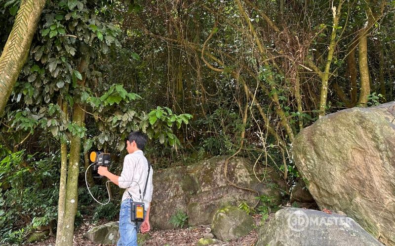
Technicians carry a 3D scanner using LiDAR technology combined with SLAM and walk along the planned routes. The equipment continuously scans trees, terrain, and surrounding objects while recording its movement and position to generate a Point Cloud in real time.
Keep the scanner stable and move consistently along the designed route.
Scan the entire area and adjust direction when encountering obstacles.
Pass through part of the previously scanned area to create overlapping data and support data registration.
Avoid sudden rotation or abrupt changes in direction.
Monitor data quality, trajectory, and equipment warnings.
Finish at the predetermined loop-closure point.
Quickly check the Point Cloud and perform additional scans if any areas have insufficient data coverage.
With 3D scanning equipment, the survey route directly affects data quality. Therefore, the area should be scanned with consistent coverage, including intersecting routes or closed loops to help reduce errors. Scanning time should also be controlled to minimize the risk of trajectory drift.
After scanning is completed, the data is imported into Point Cloud processing software to check the trajectory, evaluate data quality, and make corrections if necessary.
Import data from all scanning routes.
Check trajectories, data registration, and coverage.
Check errors, trajectory drift, and Point Cloud continuity.
Remove noise and erroneous points.
Classify points into relevant groups.
Separate ground points and vegetation when necessary.
Standardize the coordinate system.
Export data into formats suitable for CAD/GIS applications.
If the purpose is only natural forest area calculation, the focus should be on accurately identifying the boundary of the area. If forest condition analysis is also required, the data can be further used to evaluate the forest's 3D structure.
Step 4: Identifying Forest Area Boundaries
This is the step that directly determines the results of natural forest area calculation. After the Point Cloud has been processed, technicians identify the boundary of the area to be calculated based on the scanning data combined with:
Field survey boundaries.
GNSS/GPS coordinate points.
Existing condition maps.
Remote sensing or aerial imagery, when available.
Actual terrain conditions.
Features separating forested and non-forested areas.
Management boundaries, forest plots, compartments, and sub-compartments according to project documentation.
In official forest inventories, boundaries need to be verified against field conditions and comply with applicable standards and procedures. This work includes forest condition delineation, additional verification, and digital map preparation.
Step 5: How to Calculate Natural Forest Area Using Processed Data
Once the boundary has been identified, the data is converted into a closed boundary or polygon for area calculation.
The process includes:
Point Cloud → boundary identification → polygon creation → coordinate system assignment → area calculation → result verification → data export.
These steps can be performed using Point Cloud processing software, CAD, or GIS, depending on project requirements. However, in forest inventory work, areas are commonly calculated directly from inventory maps using GIS or specialized software.
What Else Can 3D Scanning Support in Forest Management?
Beyond natural forest area calculation, 3D scanning technology serves as a comprehensive digitalization platform for modern forestry:
Digitizing forest conditions: Transforming raw forest data into digital assets that can be managed using computer-based systems.
Building 3D models of forest areas: Reconstructing detailed information about tree height, canopy density, and vegetation volume.
Surveying terrain and spatial conditions: Analyzing slope, aspect, floodwater levels, and potential forestland landslide risks.
Supporting area boundary identification: Clearly distinguishing between natural forest land, planted forests, and surrounding agricultural land.
Storing forest condition data for comparison: Creating a baseline database for year-by-year comparison.
Supporting mapping and spatial analysis: Producing thematic maps, such as forestry maps and forest fire zoning maps.
Monitoring changes through periodic surveys: Supporting the early detection of deforestation, encroachment, or forest degradation.
Integrating with GIS and other geospatial data sources: Incorporating 3D scanning data into broader environmental and natural resource databases.
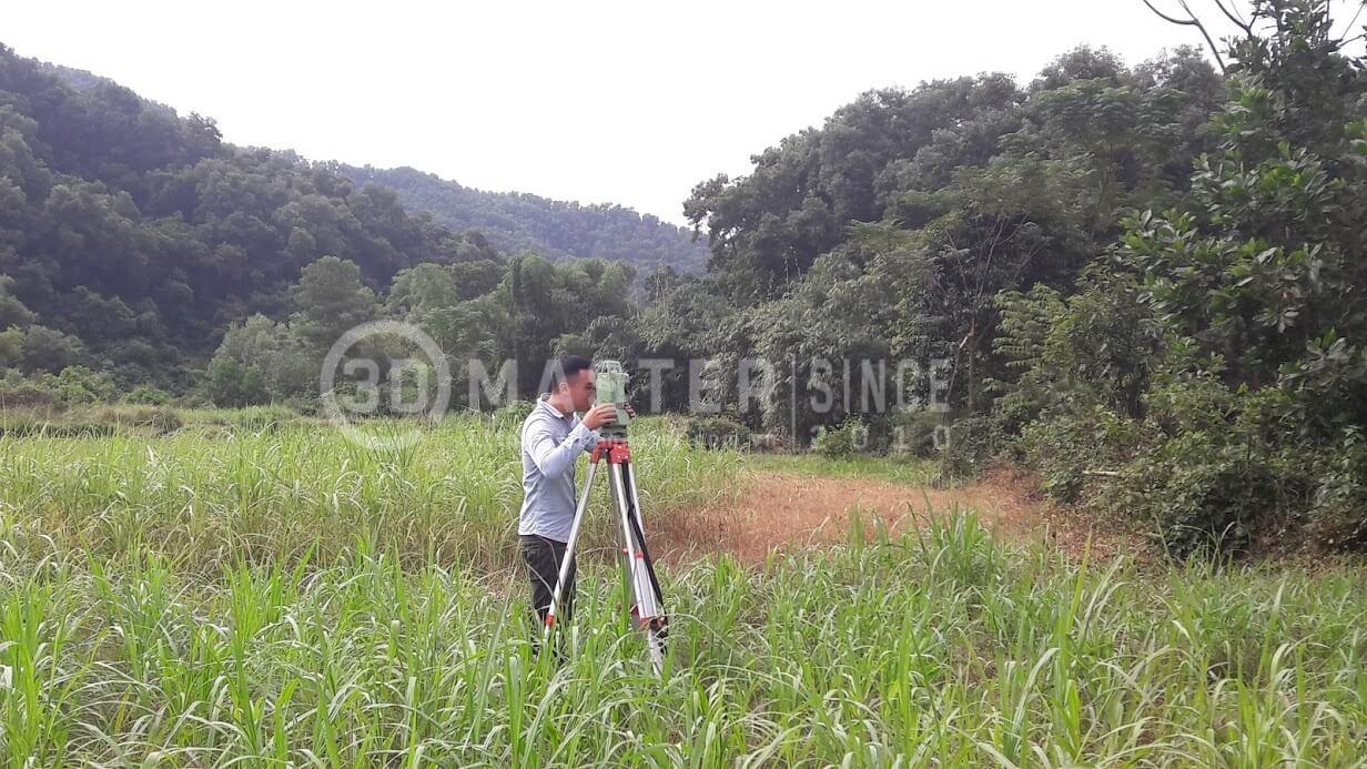
Technicians use handheld 3D scanners while moving along survey routes to collect data
3D Master’s 3D Scanning Service for Fast and Accurate Natural Forest Area Calculation
If forest management boards, businesses implementing projects related to land and forest resources, or surveying and consulting organizations are looking for a solution to optimize surveying and natural forest area calculation or planted forest area calculation, professional 3D scanning services from 3D Master can provide a suitable solution.
Modern equipment: Advanced LiDAR-based 3D scanning systems capable of rapidly collecting spatial data across large forest areas.
High measurement accuracy: An experienced engineering team combined with specialized processing software to support highly detailed and accurate measurement results.
Optimized time and costs: Reducing surveying time by up to 80% compared with traditional methods while minimizing labor requirements and operational risks.
Extensive field experience: Practical experience gained through multiple carbon credit calculation and real-world 3D digitization projects across various types of complex forest terrain.
3D Master’s 3D scanning service workflow can be organized according to the requirements of each project, from the initial survey through to data delivery. Depending on the project requirements, deliverables may include Point Clouds, boundary data, maps, 3D models, and processed datasets for subsequent applications.
Overall, 3D scanning helps make natural forest area calculation faster, more intuitive, and significantly reduces the workload associated with manual measurement. Point Cloud data not only supports boundary identification and area calculation but can also be reused for mapping, forest condition digitization, and forest change monitoring. This is a suitable solution for organizations seeking to improve the efficiency of forest surveying and management using modern spatial data.

.jpg)
.jpg)